
Following in the Footsteps of Lewis & Clark
Corps of Discovery II Markers
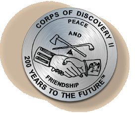 This brass Corps of Discovery II marker commemorates the symbolic start of the Lewis and Clark expedition. Initiated by Thomas Jefferson, the expedition began to explore and map America in 1803.
To honor Lewis and Clark's contributions to mapping, NOAA’s National Geodetic Survey (NGS) is installing a series of commemorative markers along the route that Lewis and Clark traveled, beginning in Monticello in Virginia and ending at Fort Clatsop in Oregon. NGS is positioning these markers using modern techniques, including the satellite-based Global Positioning System. The markers will become part of the National Spatial Reference System (NSRS), the federal standard and foundation for all positioning and navigation activities in the United States.
Jefferson: The Beginning
As the son of an active surveyor, Thomas Jefferson was exposed to the world of mapping and charting at an early age. Although Jefferson chose law as his profession, in 1773 he briefly considered a career as a surveyor. He was commissioned as the Albemarle County, Virginia, surveyor on October 14, 1773, but did not enter a complete survey into the books during his time of appointment. Even though Jefferson decided to go into law and then into politics, he realized the importance of surveying throughout his life, recognizing that a nation could not be newly built without an accurate system of reference points.Jefferson’s desire to improve the land and the life of its inhabitants further fueled his aspirations for discovery and exploration. Jefferson saw an integral relationship between man and the earth, believing that the land was given to man to civilize and cultivate. In correspondence to James Madison, dated October 28, 1785, Jefferson writes "It is not too soon to provide by every possible means that as few as possible shall be without a little portion of land. The small landholders are the most precious part of a state.” Jefferson made this philosophy become reality through the order and consistency of surveying. He proposed a methodical plan to distribute equal amounts of land in the Northwest Territory, where disputes and confusion over land possession were common.
Sending Lewis and Clark on the Trail
Even before becoming president in 1801, Jefferson had dreamed of probing the uncharted West for many years. He was involved in several expeditions sent to find a water passage to the west coast of North America, but they were unsuccessful. Yet, these attempts gave Jefferson experience in exploration, providing a basis for his future pursuits of mapping unknown land. Jefferson’s presidency gave him the necessary resources to seriously consider exploration of the West. In his first 1801 inaugural address, he saw “A rising nation, spread over a wide and fruitful land, advancing rapidly to destinies beyond the reach of mortal eye.” Less than two years later, on January 18, 1803, Jefferson followed through with his vision, requesting $2,500 from Congress for the Corps of Discovery, which became known as the Lewis and Clark expedition.In May 1804, as Lewis and Clark were about to move west along the Missouri River, Jefferson wrote, “We shall delineate with correctness the great arteries of this great country: those who come after us will fill up the canvas we begin.” While Jefferson directed Lewis and Clark to gather information about the people, animals, and plants of the West, one of his main objectives was to chart the territory, hoping to find a waterway to the Pacific Ocean. In his instructions to Meriwether Lewis, Jefferson writes, “Beginning at the mouth of the Missouri, you will take observations of latitude and longitude at all remarkable points on the river, & especially at the mouths of rivers, at rapids, at islands & other places & objects distinguished by such natural marks & characters of a durable kind, as that they may with certainty be recognized hereafter.”
The Survey of the Coast
 After the success of the Corps of Discovery expedition, Jefferson desired to survey the Eastern coast of America, because shipwrecks commonly occurred. With a clear delineation of the coastline, many products and ships could be saved, expanding commerce and industry. An act was passed by Congress on February 10, 1807, authorizing Jefferson to establish an organization to survey the coasts of the United States.
Be it enacted by the Senate and the House of Representatives of the United States of America in Congress assembled, That the President of the United States shall be, and he is hereby authorized and requested, to cause a survey to be taken of the coasts of the United States, in which shall be designated the islands and shoals, with the roads or places of anchorage, within twenty leagues of any part of the shores of the United States; and also the respective courses and distances between the principal capes, or head lands, together with such other matters as he may deem proper for completing an accurate chart of every part of the coasts within the extent aforesaid.After analyzing the ideas of several surveyors, Jefferson chose Swiss-born Ferdinand Hassler to become the Superintendent of the new bureau, called the Survey of the Coast and directed by the Treasury Department.
In 1878, the agency was reorganized and given a new name, the Coast and Geodetic Survey (C&GS), which it maintained until 1970. The name C&GS acknowledged the importance of geodesy, the science concerned with measuring the size and shape of the earth, to surveying. In 1970, a reorganization created the National Oceanic and Atmospheric Administration (NOAA), and the National Ocean Service (NOS) was created as a line office of NOAA. Part of C&GS became the National Geodetic Survey, which is currently responsible for evolving and maintaining the National Spatial Reference System (NSRS).
Surveying Today with NOAA’s National Geodetic Survey
Today, the mission of NOAA’s National Geodetic Survey (NGS) is to ensure that the United States has a consistent, high-accuracy geodetic reference foundation that supports a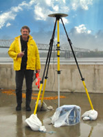 multitude of needs. The safety and efficiency of the buildings we live in and work in, the roads and bridges we drive on, and the trains, airplanes, and ships that carry the products we use everyday, all depend on a universally compatible system of geodetic reference points that tie our nation together. Until recently, NGS has relied on using conventional line-of-sight survey measurements, much like Lewis and Clark did, to provide this national geodetic framework.
The advent of the Global Positioning System (GPS), however, has irreversibly transformed this landscape. Developed by the U.S. military, GPS is a constellation of satellites that transmit their signals to receivers all over the world. GPS enables geodetic positioning to be accomplished without having to physically see or measure distances between survey points. Using GPS, a survey that once took days or weeks to complete can now be done in a few hours at a much lower cost. GPS has not only revolutionized the traditional civilian navigation, surveying, and mapping professions, but has spawned numerous new applications in industrial sectors not previously dependent on geodesy. NGS provides the infrastructure that facilitates public and private civilian applications of GPS. The virtually unknown geography of western America, described as a blank canvas in Jefferson’s time, is now well documented by the framework of NSRS, and it can be viewed by all GPS and GIS users. (all above information is from http://lewisandclarkbiography.com/)
Lewis and Clark & National Parks:
Educational Resources:
Teaching Units & Lesson Plans brought to you by http://www.lewisandclarkexhibit.org
| THEME | TARGET GRADE LEVEL | |||
| Preparing for the Trip Meriwether Lewis went to Philadelphia to buy equipment and study for the expedition. To succeed, he needed to fit what he would observe into the framework of European learning. | Elementary and Middle School, Grades 4 - 8 High School, Grades 9 - 12 | |||
| Politics & Diplomacy Lewis and Clark, as diplomats, were armed with gifts, trade items, and diplomatic protocols developed between Indians and Europeans. They stepped into a world of complex tribal relationships. | Elementary and Middle School, Grades 4 - 8 | |||
| Mapping To Lewis and Clark, mapping was a matter of measurement. They followed the European system for locating every point on earth. Indians drew maps differently, showing interaction with the landscape. | Middle School, Grades 6 - 8 High School, Grades 9 - 12 | |||
| Women The expedition had limited understanding of Indian women. Lewis and Clark wrote that Indian women were oppressed. They failed to see the powers that Mandan women possessed. | Middle and High School, Grades 6 - 12 | |||
| Animals Europeans believed nature, like their society, was arranged in hierarchies. To understand nature, they needed to know each animal's rank. Indians saw nature as a web of relationships. | Elementary, Grades 4 - 6 Middle and High School, Grades 6 - 12 | |||
| Language Lewis and Clark moved in a complex world of language. Language in Indian societies extended into space and movement — how a person stood, wore his clothes, gestured, and performed rituals. | Elementary and Middle School, Grades 4 - 8 | |||
| Warriors/Soldiers In both cultures, a warrior's clothing was his identity. Symbolic insignia revealed a complex code about who a man was and what he had accomplished. Military heroism needed no translation. | Middle and High School, Grades 6 - 12 | |||
| Trade & Property Lewis and Clark looked at Indians and saw only poverty. But wealth can be defined differently. One culture saw value in accumulating wealth; another gained status by giving it away. | Elementary, Grades 4 - 6 Middle and High School, Grades 6 - 12 | |||
| Plants Lewis wrote detailed plant descriptions and noted how Indians used plants. The Nez Perce relied on plants for medicine and nourishment. Gathering plants was done with proper ceremony and reverence. | Elementary, Grades 4 - 6 Middle and High School, Grades 6 - 12 | |||
More Educational Resources and Activities (titles are linked)
Discovering Lewis and Clark archive is a collection of research, stories, maps, multimedia, and cultural comparisons about the Corps of Discovery. This is a legacy web site focusing on persistent issues, core values, and changing visions from the decade of the expedition and the intervening 200 years.Discovery Expedition is for anyone who wants to communicate about the ongoing bi-centennial commemoration of the Lewis and Clark expedition. Discussion of Lewis and Clark re-enactments and activities.
Discovery Expedition is a part of The Discovery Expedition of St. Charles, Missouri, which is a nonprofit organization dedicated to rediscovering the legacy of Lewis and Clark. They promote education and the study of American history and heritage through discussions and living history demonstrations.
History of the Expedition from Lewis and Clark Trail Heritage Foundation.
Read online about the Journals of the Lewis and Clark expedition.
Lewis & Clark National Historic Trail - National Park Service.
PBS Online: Lewis and Clark The Journey of the Corps of Discovery.
National Geographic Xpeditions: Lewis and Clark Relive the spirit of Lewis and Clark by planning your own expedition or extreme adventure.
Moving panoramas were in use in America at the time of Lewis and Clark. Make your own moving panorama.
National Geographic: Lewis and Clark journal entries, maps, historical photos, drawings, and more.
Sacajawea biogrpahy includes timeline.
The Life of Sacagawea from the United States Mint has some information about Sacagawea and the Golden Dollar Coin featuring her.
Sacajawea on the Lewis & Clark National Historic Trail
More Lesson Plans
- Learn more about Sacajawea and her tribe
- Lewis and Clark: Mapping the West lesson plans
- Lewis and Clark classroom resources and lesson plans
- Lewis & Clark for educators has teaching units and lesson plans
- Lewis and Clark: American Explorers
- Lewis and Clark Expedition
- Lewis and Clark at Scholastic
- Teaching With Documents: The Lewis and Clark Expedition
- Lewis & Clark in Columbia River Country lesson plans
- More lesson plans are listed at MrDonn.org
- Westward Journey Nickel Series Lesson plans resource guide includes background information, reference resources, and reproducible coin images and worksheets related to the journey of Lewis and Clark and the Westward Journey Nickel Series.
http://www.lewis-clark.org/
http://lewisandclarktrail.com/101.htm
http://www.lewisandclarkexhibit.org
http://lewisandclarkbiography.com/
http://lewisandclarktrail.com/101.htm
http://www.lewisandclarkexhibit.org
http://lewisandclarkbiography.com/
Maps
View the routes taken by Lewis and Clark. Eduplace offers free pdf historical outline maps.The Map of The Lewis and Clark Expedition.
Crafts
|
 Craft Activity
Visit here for directions - http://www.nps.gov/archive/jeff/lewisclark2/Education/Lewis&ClarkFestival/MovingPanorama.htm
FOLDING PANORAMA

Visit here for directions - http://www.nps.gov/archive/jeff/lewisclark2/Education/Lewis&ClarkFestival/FoldingPanorama.htm
Field Trip - Cities and States
Lewis & Clark in St. Joseph, MO.To many of today’s explorers retracing the path of Lewis and Clark’s Corps of Discovery, North Dakota still marks the beginning of the vast unknown. Discover the same wide-open natural splendor, abundant wildlife and warm hospitality that greeted Lewis and Clark along the Missouri River two centuries ago. The State Historical Society of North Dakota has identified and marked 28 locations of significance to Lewis and Clark’s expedition.
The Lewis and Clark Trail is a cultural destination that covers over 4,600 miles, crosses four time zones, and showcases some of the most beautiful and rugged areas of America. They have lesson plans, timelines and more.
Links by state in chronological order in which the Expedition passed through.
No comments:
Post a Comment